|
|
Paddling Canada’s Rideau Canal National Park
By Ralph Heimlich. Photos by Ralph Heimlich and Greg Welker.
|
|
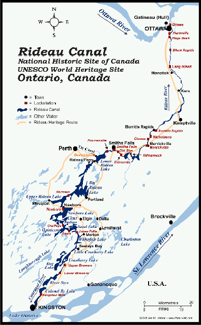
When they hear the word “canal,” most people think of a boring, straight-sided, man-made stretch of water that holds no intrinsic interest for the paddler. Canada’s Rideau Canal National Park, a UNESCO World Heritage Site, is none of those things. Designed as a slack water canal system (fed by many dams and weirs that back up rivers into natural and man-made lakes), the system stitches together broad lakes, narrow rivers and widely flooded wetlands over 126 miles between Kingston and Ottawa, joined by short sections of narrow dug canals, often in steep-sided troughs. The Rideau system, in Ontario Province, combines rocky and bucolic scenery, crystal clear water, abundant submerged aquatic vegetation, history, and small-town ambience into a seamless paradise for boaters, equally appealing to small and large craft alike.
As many of our jaunts do, this trip began with a late winter email from inveterate paddler Greg Welker, wanting to know if I’d ever heard of the Rideau Canal. Always on the lookout for new paddling venues, Greg had heard about the Rideau on one of his trips into Canada. After doing some research, Greg recruited several of us (Dave Isbell, John Garon and myself) for a 10-day early July trip to do as much of the waterway as possible.
We traveled to Canada in three vehicles: Greg from Maryland, John from Maine, and Dave and I the following day, convening at the Rideau Acres Campground at Kingston Mills.
|
|
|
Set amidst RVs and permanently moored unmobile homes, our grassy campsite was right on a flooded wetland forbiddingly known as the Styx River. There is no demon Charon guarding the crossing here. The river got its name from the standing timber killed by the rising waters of the dammed Cataraqui River.
The only outfitter we could find to assist us with the shuttle could only haul two boats, so one day was devoted to four hours of driving from Kingston to Black Rapids, Lock 13, to leave my truck with four kayak racks for the return shuttle. We had sought secure parking closer to the systems terminus at Ottawa’s famed Seven Steps lock, but repeated inquiries indicated the last usable parking was at Black Rapids. A self-service parking fee machine ($5.00 CND/day) was out of order when we arrived, and the Lockmaster said he wasn’t collecting the parking fees, but would keep an eye on the truck. We arranged with Rideau Acres to park the other two vehicles there during our trip.
Looking at the flat, swampy terrain and dense scrubby tangle of trees bordering the road back to camp, one wondered at the perseverance of the early canal builders and settlers to this area. The Rideau canal was an out-growth of the War of 1812, when American forces along the St. Lawrence River threatened to cut off Canada’s important Great Lakes naval base at Kingston from Montreal and Quebec. After the war, a survey of the old canoe route from Kingston to Ottawa along the Cataraqui and Rideau Rivers indicated that a canal could be constructed enabling a supply line from Montreal up the Ottawa River and then down to Kingston in the event of renewed hostilities with the upstart Americans. In 1819, the Duke of Wellington, then serving as Master-General of the Ordnance in charge of military construction, recommended creating the Rideau Canal, and in 1826, a commission of the Provincial legislature approved construction, handing the task to Lieutenant Colonel John By of the Royal Engineers.
After much hardship, trials, tribulation, and “adaptive engineering,” the canal was completed in 1832. Never needed in war time, the canal served peaceful commerce and was a major factor in settling the area. Forward-looking design by Colonel By led to increasing use of steam boats rather than draft animals on tow paths to haul barges through the system and resulted in multiple luxury steamships making the passage from Kinston to Ottawa and back each week by the end of the 19th century. As railroads supplanted barge traffic, the Rideau became known as a recreational waterway, famous for bass fishing and summer cottages. In 1972, it was transferred to Parks Canada, designated a heritage river in 2000 and as a UNESCO World Heritage site in 2007.
We packed up everything, including our kayak wheels, and launched from our campsite early on Friday. We had planned an easy day, paddling only 10.5 miles on the River Styx, which narrowed down as we paddled north, to our first lock, Lock 45 at Lower Brewers.
Negotiating a lock is a pretty easy process. There is a fee for locking through, but we had all paid in advance for a season sticker, affixed to front deck of each kayak. The sticker price is based on the length of each boat. At most of the locks, staff took down our sticker numbers, which we all soon memorized. There is a dock or quay with the edge painted bright blue, known as the Blue Line, where you pull up and wait in line in company with everything from canoes to yachts for the lock to open. This can take as much as 30-45 minutes, depending on traffic coming from the other direction. When the lock gate opens, oncoming traffic exits and you are directed into the lock. Small craft are usually put at the back of a lock because of the turbulence caused by letting water into or out of the lock at the gate. We nested up and the kayak nearest the wall held onto rubber-coated wire ropes set into the dock wall. Once the gate was closed behind us, lock staff opened gates in the upstream lock and water started to fill the lock, lifting us as much as 12 feet. As soon as the water reaches the level of the upstream section, the lock gates can be opened and all the boats in the lock are ushered out.
Many locks are arranged in sets or “flights” which accomplish multiple lifts in several steps. Lower and Upper Brewer locks are joined by a section of the Cataraqui River that skirts old farms and orchards. We paddled on to Upper Brewers (Locks 44 and 43 in a two-lock flight) and locked through to camp on the upstream end of the flight since the locks do not begin to operate until 9:00 a. and we preferred an early start in the cooler morning air. All together, the three Brewer locks lifted us 31 feet.
|
|
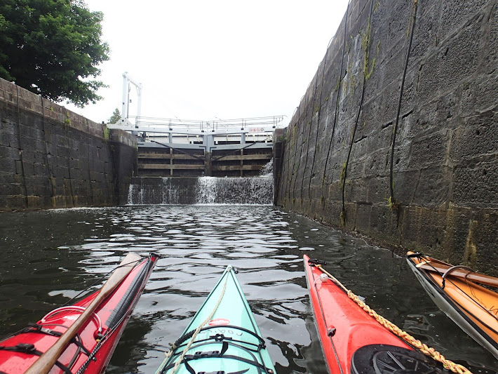
Negotiating Brewer Locks. Credit: Ralph Heimlich.
|
|
|
Camping is available at all the locks we passed, for a fee of $4.90 CDN per person. Grassy areas with picnic tables and charcoal grills are available along one or both sides of the canal at one or both ends of the lock. There are nicely appointed washrooms at each lock house, including some with showers, and potable water available at nearly all of them. Landing at the camping areas can be a bit of a challenge since there are seldom beaches or shallow areas to disembark. Instead, floating docks, or more often, rafts of the large timbers used to isolate the locks for maintenance are available, requiring sometimes ungainly dock landings (we often looked like large seals flopping belly first onto the timbers), and feats of strength and balance to pull loaded kayaks up and onto the docks.
|
|

Our camp at Upper Brewer Lock. Credit: Ralph Heimlich
|
|
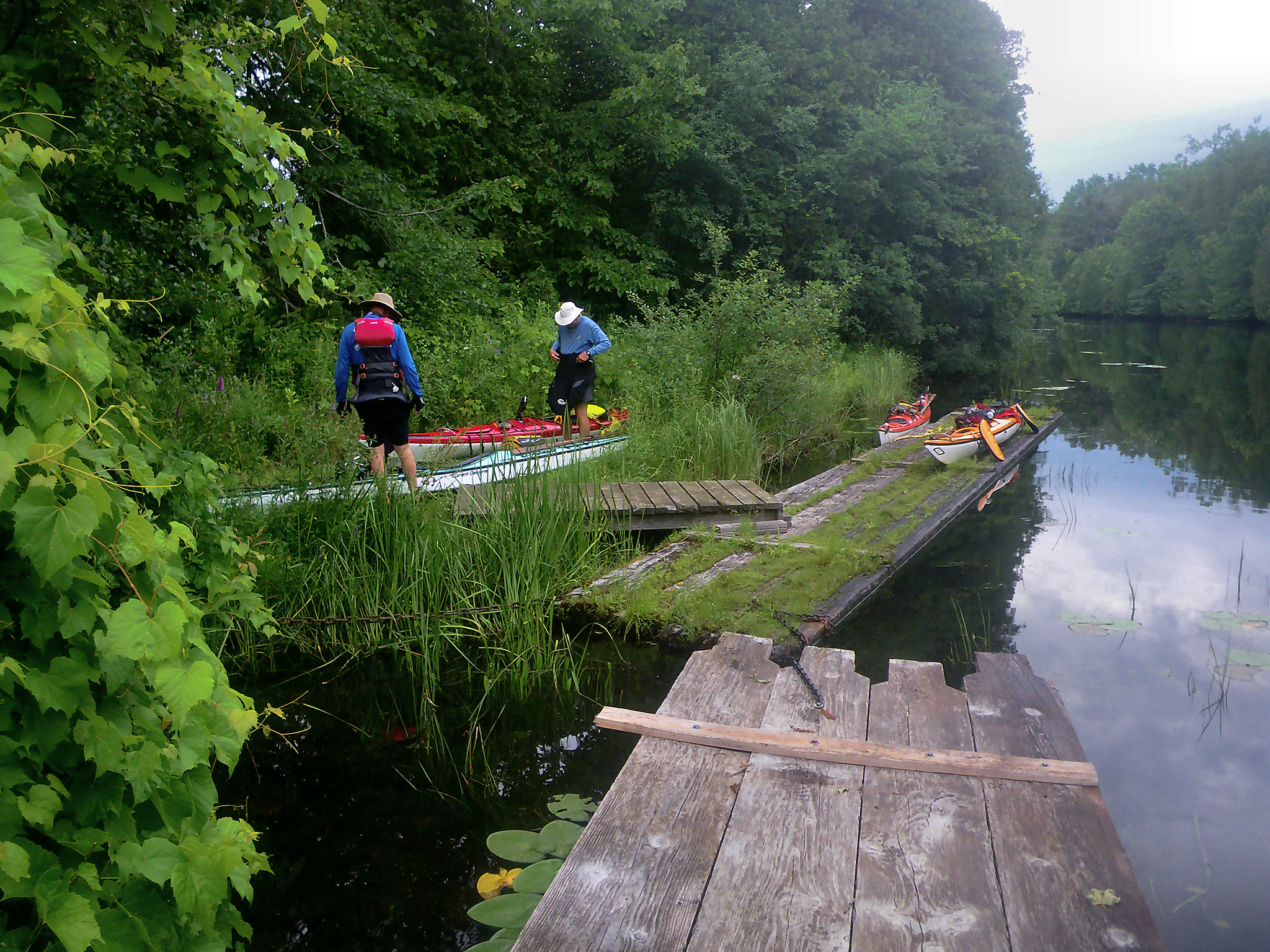
Landing at a canal dock. Credit: Greg Welker
|
|
|
There are numerous red and green buoys marking the channel through the lakes and rivers of the system (more than 600 from Newboro to Kingston and another 500 or so from Newboro to Ottawa). The buoys change “hand” at Newboro (red right returning in each direction to Newboro). The buoys are necessary for larger boats because the channel is only dredged and maintained within the buoys and, especially in early days, the stumps of drowned trees littered the flooded lakes bottoms. Navigating by kayak requires careful consideration of your destination, winds and wind shadow, and points of interest since it often pays to leave the channel with our shallower draft.
Upper Brewers Lock has a defensible stone lockmasters house (now a private residence) with gun slits still visible in the stone blockhouse walls. It also has a 19th century houseboat called the Ark, hauled ashore now for use as a summer cottage. Many of the locks have swinging bridges for road crossings, and Lower Brewers has one of the best examples of an Unequal Arm Center bearing timber bridge so well balanced it can be swung by a single person.
|
|
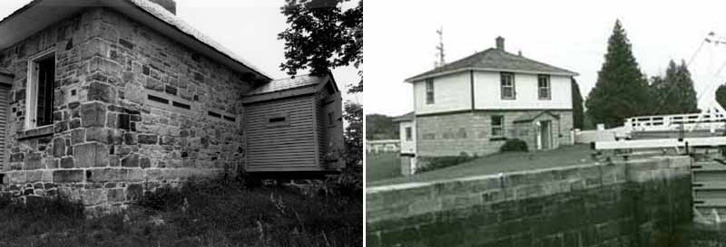
The lockmasters' houses on the Canal were made defensible with rifle slits, now often boarded or bricked up. Photos courtesy of Parks Canada.
|
|
|
This area of Ontario is far enough north that twilight lingers until nearly 10:00, but we eventually turned in and spent a peaceful night listening to the water flow through the locks, which are drawn down at night.
Saturday morning we awoke and packed our dewy tents, launching onto the misty river well ahead of the boat traffic that we expected would get heavier later in the day. Our target for the day was Chaffey’s (Lock 37) 17.1 miles away. We would be passing through Cranberry Lake, under the Brass Point bridge, Whitefish Lake, Sand Lake, and the Jones Falls (Lock 39-42) and Davis (Lock 38) locks. As we passed out into Cranberry Lake, we passed through the “Court of the Duke” where a rock outcropping resembles the profile of the Duke of Wellington, a proponent of the canal. Paddling north, the terrain became rockier, water became clearer and chillier, and the forest increasingly dominated by cedar, spruce, and white pine, resembling the Adirondacks.
|
|
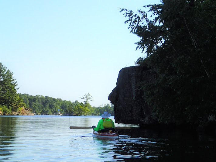
At the “Court of the Duke” with Wellington’s profile in stone. Credit Ralph Heimlich.
|
|
|
Jones Falls is a flight of four locks, totaling 58 feet of lift. It is the site of the Great Stone Arch Dam, the world’s highest at 60 feet when it was completed in 1831, and a particularly pretty Lockmaster’s House set on a hill over the lock. After passing through Davis (Lock 38, 9 foot lift), we entered Opinicon Lake, with Chaffeys Lock and the Opinicon Resort at its head, where we again locked through.
Chaffeys Lock is a bit more urbanized, with houses facing our campsite on the opposite side of the lock and street lights lining the walk along the canal. It also has the somewhat swanky Opinicon Resort, where we eschewed freeze-dried food for cold draught beer and ice cream and mingled with the power boaters and golfers. After we turned in, the night was shattered with the laughter of children as a local family had an impromptu swim party in the closed lock, a tradition we observed at several locks along the route.
|
|
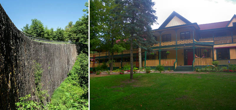
L: Arched masonry dam above Jones Falls. R: Opinicon Resort at Chaffey’s Lock. Credit: Greg Welker
|
|
|
Our Sunday route was 13.6 miles through Indian, Clear and Newboro Lakes, and through a narrow cut into Upper Rideau Lake, where the wind had increased to 10-15 mph, raising whitecaps and making for a slog dead ahead into the wind. We were glad of our decision to paddle kayaks here since these waves would have been tricky for our low-volume solo canoes. Newboro (Lock 36, 7.7 feet) is the height of land, so the buoys changed “hands” here. We had been lifted 118.2 feet coming from our start. We were now locking “downstream” a total of 163.3 feet. I had always thanked the lock staff for giving us a “lift,” but now started thanking them for letting us “drop in.”
After beating across the obstreperous wind, we finally entered the approach to Narrows (Lock 35, a mere three-foot drop). This lock in the middle of a lake was built to accommodate a dam which artificially raised the level of both lakes, reducing the amount of excavation required. A well-preserved blockhouse, one of a chain that “defended” the canal, is located here and houses a museum. After locking through, we hugged the northern shore of Big Rideau Lake, although the wind died off. We dropped down to Colonel By Island, one of our few non-lock campsites.
|
|
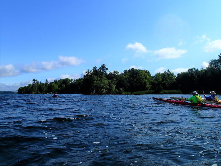
Heading into the wind at Upper Rideau Lake. Credit Ralph Heimlich.
|
|
|
Colonel By Island, in the middle of Big Rideau Lake, was formerly the Wag’s Lodge, owned by Danny Arnstein, a New York taxi-cab mogul. The flat-topped inn building is still there, but falling to ruins. We camped on the grass in front of the old lodge and shared the space with several garrulous power boaters docked at the pier, who exhibited great interest in the American paddlers. There is a two-km walking trail around the island, so this was one of the few stops on our tour where we could stretch our legs.
|
|
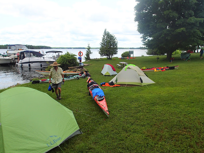
Our campsite at Colonel By Island. Credit: Ralph Heimlich.
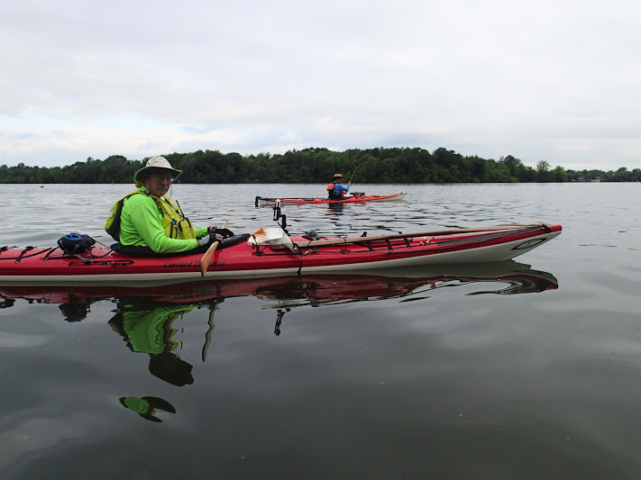
Paddling heaven on the Rideau Canal system. Credit Ralph Heimlich.
|
|
|
Monday was another long paddling day, 16 miles from Colonel By Island to Poonamalie (Lock 32, 5.7 foot drop), passing out of Big Rideau Lake to Lower Rideau Lake, and by the Tay Canal, an offshoot that locks up to the town of Perth. Poonamalie was named by a British engineer because the terrain reminded him of a hill town in northern India where he had served. In addition to the usual camping facilities, there was a newly rebuilt one-km concrete and rock dam and weir that borders the canal on the north side. In 1904, a 300- by 75-foot ice floe off the Rideau Lakes knocked a huge hole in the old dam and nearly flooded the downstream town of Smith Falls.
On Tuesday, we awoke to our most heavily locked day: 16.8 miles to Merrickville, passing through the combined locks at Smiths Falls (Locks 29a and 31, 34.5-foot drop), the double lock at Old Slys (26 and 27, 16-foot drop), Edmunds (Lock 25, 9-foot drop), Kilmarnock (Lock 24, two-foot drop) and the three locks at Merrickville (Locks 21-23, 24.7-foot drop). The lockmaster at Poonamalie touted a good restaurant in Smiths Falls that opened at 6:30, so we packed up early and did the half-hour paddle on empty stomachs. We ran into our first group of paddle tourers, a party of three Canadian military officers canoeing a short stretch from Smiths Falls to Burritts Rapids. They told us the big story for Smiths Falls: A defunct Hershey chocolate factory was getting new life growing legal marijuana and producing Mary J edibles.
After chatting with the officers, we went on to the “Roosterant” in our dripping paddling clothes for a hearty Canadian breakfast, then got back into the boats in time to lock through Smiths Falls. This set of locks is the largest single change of level on the canal system, with one lock dropping 26 feet. We felt trapped in a deep canyon when the gates finally opened at the bottom of that drop.
|
|

Waiting in the “Blue Line” at Smiths Falls. Credit: Ralph Heimlich.

The big “drop” at Smiths Falls. Credit: Greg Welker.
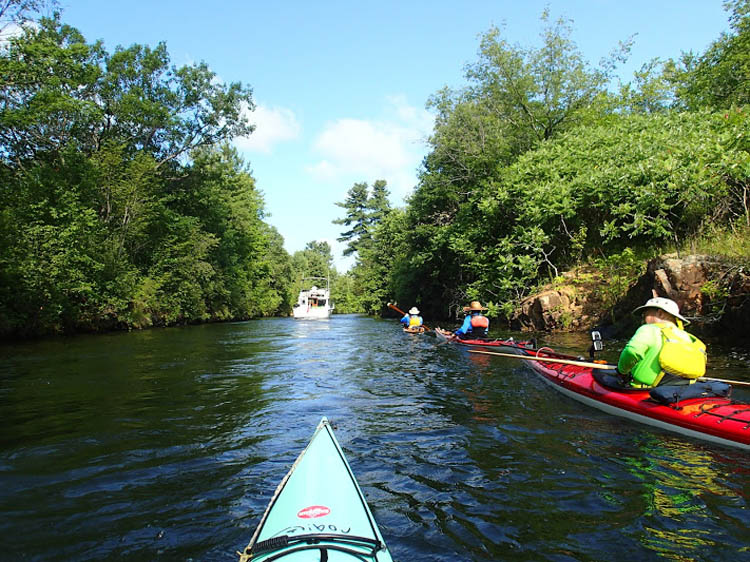
One of the narrower stretches. Credit: Ralph Heimlich.
|
|
|
Merrickville is the most scenic town on the Rideau Canal, with a pleasant main street fronted by antique stone buildings. After setting up camp, we strolled into town to resupply with fresh fruit, snacks, and ice cream. We also toured the block house museum, getting fresh insights into the building and history of the canal.
After Smiths Falls, the scenery gradually transformed from rocky evergreen lakes to broad, slow-moving sweeps of agricultural land, dotted with large dairy farms perfuming the air. Reminiscent of New York’s Ontario Lake plain, the heat and humidity intensified as we paddled along 15 miles through Lock 20 at Clowes, Upper and Lower Nicholson (Locks 19 and 18), and Burritts Rapids (Lock 17). Even cutting off some of the longer bends in the channel, we were happy to finally arrive at our campsite at Rideau Provincial Park. We used our wheels to roll to spots as near the water as possible, and enjoyed the showers and ice cream at the camp store.
|
|

Invading Merrickville in search of groceries and ice cream. Credit: Greg Welker.

The Block House museum at Merrickville. Credit: Ralph Heimlich.

Agricultural scenery below Smith’s Falls. Credit: Ralph Heimlich.
|
|
|
Friday was our final day on the canal system, with a scant five miles to our terminus at Black Rapids (Lock 13). We arrived after only a couple of hours and put in at the upstream end of the lock, loaded our boats on kayak wheels, and pulled them into the parking lot. The parking fee machine was still out of order, so we loaded all four kayaks, all the gear, and our sweaty bodies into my truck for the two-hour drive back to Rideau Acres.
After setting up camp and getting much-needed showers, we climbed in the truck to explore downtown Kingston. On this hot, busy Saturday, we fit right in with all the other tourists, gawking at the retired Canadian Pacific Locomotive, the War of 1812-era fort and four Martello towers guarding the harbor, the monument to the Irish quarantine victims, and posing with the “Kingston” sign. After walking around the city’s waterfront, we got dinner at a typically Canadian restaurant, Diane’s Fish Shack and Smokehouse, right on Ontario Street. I ordered the Seafood Poutine, which ought to be Canada’s national dish (fries, coconut green curry, shrimp, haddock, calamari, mussels, queso fresco).
|
|
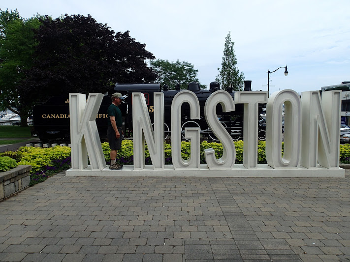
Who is the “I” in Kingston? Credit: Ralph Heimlich.

The Canadian National Dish, IMHO. Credit: Dianne.
|
|
|
After one more night of camping at Rideau Acres, we packed up in the early morning as quietly as possible, and made our separate ways back to the U.S. Our 110 miles paddling the Rideau Canal, we found it interesting, and our lockmasters and staff friendly and welcoming. If you are looking for your next kayak touring trip, look no further than the Rideau Canal.
RESOURCES:
Parks Canada’s online guide to the Rideau Canal.
An invaluable guide is Watson’s Paddling Guide to the Rideau Canal available as a down-loadable PDF file.
Lock stickers are available by mail from Parks Canada. We paid a cut-rate of $4.40 CDN per foot of boat length for our kayak stickers. Be sure to have sufficient Canadian currency on hand for the $4.90 CDN camping fee per person (plus ice cream and beer).
Long term parking at the locks near Ottawa required prior approval from the Park Administrator, who was very helpful in suggesting we terminate at Black Rapids, the nearest lock to Ottawa with adequate and secure parking.
All photos are available online. Ralph's photos. Greg's photos.
|
|


|
| | | | | | | | | | | |
